What is the Dapeng Peninsula?
Located in the southeast corner of Shenzhen, the Dapeng Peninsula is a protected ecological zone. Unlike the flat urban center, this area is dominated by the Qiniang Mountain range and jagged coastlines. Historically, it was a maritime fortress guarding the Pearl River Delta.
For hikers, the main draw is the “Coastline Trek” connecting the villages of Dongchong and Xichong. It is not a casual stroll; it is a raw interaction with nature where the mountains crash directly into the sea.
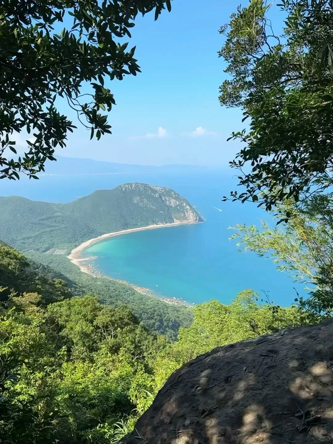
This magnificent coastal panorama, framed by verdant trees, offers a glimpse into the natural beauty of Shenzhen’s Dapeng Peninsula. A perfect reward for those exploring its hidden hiking trails.
The Main Event: Hiking Dongchong to Xichong
This is the classic route. While you can hike it in either direction, I strongly recommend starting at Dongchong and finishing in Xichong. Xichong has a larger beach, more restaurants, and better transport options for your exhausted return journey.
The Terrain: What to Expect
Do not let the word “beach” fool you. This is a coasteering route. You will spend about 60% of your time scrambling over large granite boulders and navigating narrow cliffside paths. There are rusted chains bolted into the rock to help you climb the steeper sections.
Sensory Detail: The granite here is coarse and grips your shoes well, but it will shred your skin if you slip. You will smell the dried salt on the rocks and feel the intense humidity radiating off the stone, even in winter.
Navigation and Safety
There is no paved road. You follow the coastline. Look for red paint arrows or ribbons tied to bushes by previous hiking groups. If you lose the trail, look up—paths often cut inland slightly to bypass impassable cliffs.
Insider Tip: On weekends, you might encounter locals on the rocks offering to “guide” you past a “difficult” section for 50 RMB. This is usually unnecessary. The path is well-trodden. Trust your eyes and the trail markers.
Logistics: Getting There in 2026
Transport in Shenzhen moves at “Shenzhen Speed.” As of 2026, reaching the peninsula has become significantly easier thanks to the expansion of the rail network.
Step 1: The High-Speed Train
Forget the old, traffic-clogged E11 bus. Book a high-speed train ticket from Shenzhen North Station to the newly operational Dapeng Station. The ride takes approximately 25–30 minutes. According to the official 12306 rail policy, you must use your passport to book and board.
Step 2: The “Last Mile”
From Dapeng Station, hail a taxi or Didi (China’s Uber) to Dongchong Village (东涌). The drive takes about 20 minutes. Ensure you have the destination written in Chinese to show the driver:
- Destination: 东涌 (Dongchong)
- End Point (for pick up later): 西涌 (Xichong)
Connectivity
Navigating the trail requires a working map app (Amap or Baidu Maps are superior to Google Maps here). You will also need data to pay for water or snacks at the trailhead via Alipay.
If you are visiting from overseas, you need a reliable connection that bypasses the Great Firewall to access your usual apps.
💡 Editor’s Pick: We recommend Nomad eSIM for China because it reliably bypasses the Great Firewall with stable speeds. Use code JORICAQLKF at checkout to get $5 USD off your first data plan.
Insider Tips: How to Survive the Heat
1. The “Water Economy”
You will find elderly vendors selling water and cucumbers at random points along the cliffs. Know this: The price of water correlates with the difficulty of the terrain. A bottle that costs 2 RMB in the city might cost 10 RMB on the ridge. Buy it anyway. Dehydration is the number one cause of rescue calls here.
2. Avoid the “Facekini” Crowds
Xichong Beach is famous for its clear water, but the main entrance (Gate 1 & 2) can get packed with tour groups. Upon finishing your hike at the Xichong end, walk toward Gate 4 (the surfing area). It has a younger vibe, better coffee, and fewer megaphones.
3. Check the Tide
Parts of the coasteering route are difficult or dangerous during high tide. Check a tide table for “Nan’ao” before you go. Aim to hike during a falling or low tide to expose more of the beach for easier walking.
Where to Unwind: Dapeng Fortress
After the hike, take a 15-minute taxi ride to Dapeng Fortress (Dapeng Suocheng). Built in 1394 to fight off pirates, this walled village is a maze of narrow alleys and Qing Dynasty architecture.
Unlike the sterile malls of Futian, the fortress smells of Kiln Chicken (Jiaohuaji), a local specialty where a whole chicken is wrapped in lotus leaves and baked in a mud oven. It is salty, juicy, and exactly what you need after burning 1,500 calories on the rocks.

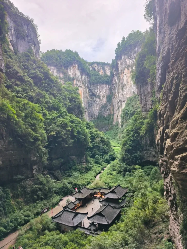
Beyond the hiking trails, the Dapeng Peninsula is home to historical treasures like Dapeng Fortress, a beautifully preserved relic of coastal defense.
Packing List for the Ridge
- Footwear: Trail runners or hiking boots. Do not attempt this in Converse or sandals.
- Gloves: Cheap gardening gloves are a lifesaver for grabbing rusted chains and sharp rocks.
- Sun Protection: The ridge is fully exposed. A wide-brimmed hat is non-negotiable.
- Cash/Phone Battery: Bring a power bank. Your phone will drain searching for signal. Bring 200 RMB in cash just in case WeChat Pay fails in dead zones.